The
Humboldt River is a river drainage system located in north-central Nevada.
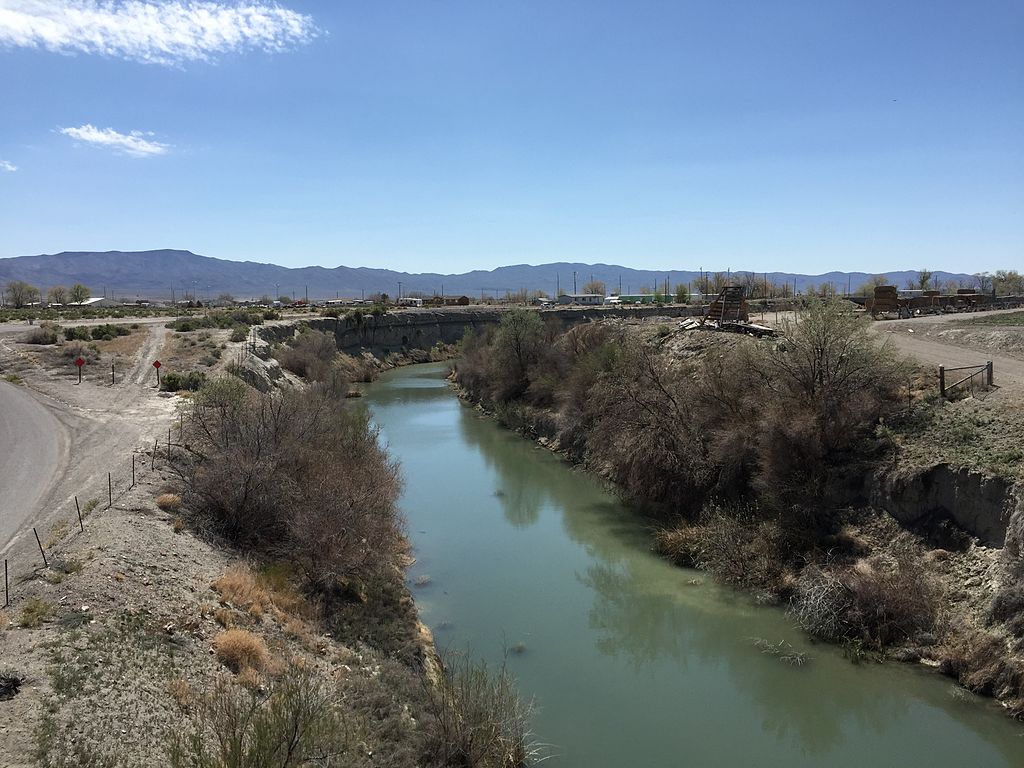
Pond along far upper Humboldt River adjacent to Elko County Rt 754 near Wells, Nevada
It
extends in a general east-to-west direction from its headwaters in the
Jarbidge, Independence, and Ruby Mountains in Elko County, to its terminus in
the Humboldt Sink in northwest Churchill County.
Humboldt Wells, the source of the Humboldt River
The river begins north of Wells (originally named Humboldt Wells). Although there are rivers and creeks that feed the river, the actual river itself starts at Humboldt Wells. From there, it
runs west to the town of Lovelock. That makes it the longest river in America
that begins and ends within the area of one state.
View from Nevada State Route 230 (Starr Valley Road) in Deeth, ctsy Famartin
Most estimates put the Humboldt River at 300 (480 km) miles to
330 (530 km) miles long. The meandering brings it closer to 380 miles. It is
located within the Great Basin Watershed.
The Humboldt River is the third longest river in the
watershed behind the Bear River at 355 miles (570 km) and the Sevier River at
325 miles (523 km). The Humboldt River Basin is the largest sub-basin of the
Great Basin encompassing an area of 16,840 square miles (43,615 km2). It is the
only major river system wholly contained within the state of Nevada.
View from Nevada State Route 789 near Golconda, Nevada
I
found an interesting article in a Elko, Nevada, newspaper about a presentation
given at the California
Trail Center
by Tim Burns, Nevada
Outdoor School education program technician, on May 2, 2018. Much of the following
information comes from that article.
View southwest along from the 9th Street Footbridge in downtown Elko, NV
The
Humboldt River might be a tiny trickle by August, but it is the longest waterway running
within a single state in the United States. The length doesn’t count the
Humboldt’s meandering ways. It meanders in a serpentine course, causing the
river to run more than twice its as-the-crow-flies distance.
Before
the great westward migration, the first inhabitants of the Great Basin made use
of the river later known as the Humboldt for millennia. Unfortunately, only
stories survive to tell us about the original condition of the valley. One of
those is a hint from John C. Fremont’s report of his 1845 exploration. He
described the valley as being beautifully covered with blue grass, herb grass,
clover and other nutritious grasses and that scattered cottonwood trees grew
along the stream banks.
Burns
went on to explain that the valley did not stay green for long once the first
American explorers started visiting the area.
“The
first white men to explore the valley were the members of Peter Skene Ogden’s
1828 expedition,” Burns said. “The river was originally named Paul’s River and
Mary’s River.”
 |
Alexander von Humboldt
|
Ogden
was sent to explore the river by Hudson’s Bay Company, a fur business. His team
was sent to create a “fur desert,” or to kill as many beavers as possible to
cut the supply for their rivals. Beaver damns declined, as did the natural
course and management of the river.
Other
explorers went in search of the Bonaventura River that was rumored to be a huge
river that flowed from the Rocky Mountains to the ocean. It was believed this
river was as large as the Mississippi. Although a myth, explorers and those
migrating west expected more than what they discovered. It was the 1845 U.S.
mapping expedition under John C. Fremont that disproved these rumors once and
for all. He named this river after a German naturalist named Alexander von
Humboldt. Mr. Humboldt never saw the river that bore his name.

Later,
people made their way west, they had to follow this waterway to survive.
Nevertheless, many of them did not regard it highly. The following are some quotes
by those who traveled the California Trail along the Humboldt River:
Railroad bridges over the Humboldt River near Hunter, NV
In
1849, Reuben Cole Shaw wrote: “The Humboldt is not good for man nor beast and
there is not timber enough in three hundred miles of its desolate valley to
make a snuff box, or sufficient vegetation along its banks to shade a rabbit,
while its waters contain the alkali to make soap for a nation.”
In
1852 a man named Gilbert L. Cole wrote: “For about 10 days the only water we
had was obtained in the pools by which we’d camp. These pools were stagnant and
their edges invariably lined with dead cattle that had died trying to get a
drink. Selecting a carcass that was solid enough to hold us up we would walk
into the pool taking a blanket with us which we would wash around and get as
full of water as it would hold, then carry it ashore where two men, one holding
each end, would twist the filthy water out into a pan, which would, in turn, be
emptied into our canteens.”
In
1850, Margaret Frank said about the Humboldt Sink: “This is the end of the most
miserable river on the face of the Earth.”
View down the Humboldt River from Interstate 80 northeast of Lovelock, NV ctsy Famartin
A
man named Addison Crane in 1852 was inspired enough to write a poem about the
Humboldt River:
Farewell
to thee, thou stinking, turbid stream,
Amid
who’s waters frogs and serpents glean.
Thou
putrid mass of filth, farewell forever,
For
here again I’ll tempt my fortunes never.
Lakes Lahontan and Lake Bonneville
Mr.
Burns explained that the reason the river’s water is so bitter is because it is
filled with alkali left over from ancient Lake Bonneville, of which the Great
Salt Lake is a remnant.
Said
Ted Burns:
“At
one point, the Humboldt River Valley was only inhabited by a few hundred people
who never stayed for extended periods of time in any one place,” Burns said.
“Then tens of thousands of wagons passed through the valley in the 1840s. Tens
of thousands of oxen, mules and horses ate the grass growing along the
riverbanks. Tens of thousands of wagon parties chopped down trees to repair
their wagons or make their campfires. Tens of thousands of thirsty people and
animals drained the river when the water level was at its lowest. Without the
plants to filter out the river, the water became even more soapy and bitter.
The immigrants were complaining about a problem they created.”
Humboldt River drawing by Daniel A. Jenks whose party reached river on July 22, 1859
Based on the information I found, in my book Pearl, I
wrote the following about Michael and his two employees as, in 1858, they
approached the end of the Humboldt River, not too many miles before the river dries
up in the Humboldt Sink. As bad as it was in the early 1850s, it did not
improve as wagon trains continued to follow its banks to California. Here is the
excerpt:
Will shook his
head as he set down another bucket next to the water barrel. “This has got to
be the nastiest-tasting water I’ve ever had the misfortune to drink. It’s so
alkaline, it’s almost like swallowing liquid soap.”
“You’re right about that.” Michael
squinted into the setting sun. “They say this river is getting worse and worse
every year. With so many people traveling its banks to reach California,
they’re using what few trees grow here for fires, leaving less available
firewood. The cattle are eating the plants that grow along the banks, so
there’s almost nothing left to help filter out all the salt.”
“Cottonwood don’t make the best
firewood, anyway.” Jeremy, who had followed behind his friend by only a few
steps, also set down his bucket. “Most of this scrub brush around here don’t
burn all that well, either.”
“Never thought I’d see the day I
missed having buffalo chips to use for fires,” Michael sighed. “I’ll have to
admit, I admire these ladies for having everything set up for cooking so they
can get as much done quickly with what little fuel we’re able to gather.”
“Where are we again, Boss?” Jeremy
looked around their camping area.
“I think this is called French Ford,
although I’m not sure you’d call it a place. There’s a Frenchman who runs a
ferry here, though.”
“If the river gets much lower, people
can walk across and won’t need no ferry.” Will pointed toward a trail leading
to the river. Next to the bank, a wooden raft was tied to a pole set several
feet inland.
“We won’t travel much farther before
this river ends in a sink. At that point, the forty miles of nothing but heat,
sand, and misery begins.” Michael inhaled deeply and shook his head. “That’s
where we’ll face the real challenge, men. We have these women and children to
get safely across, and it won’t be a pleasure stroll.”
~o0o~
Pearl, Book 16 in the Prairie Roses Collection is now
available. To find the book description and link, please CLICK HERE.
Sources:
State Historic Marker No. 45, Nevada State Park System
https://en.wikipedia.org/wiki/Humboldt_River
https://apnews.com/article/4a2ffdc8acc742ef927dcf8058c3a277


_on_the_Pony_Express_National_Historic_Trail_(2008)_(9a21230c-4bb8-4ddd-a523-7de9459a464d).jpg)


_near_Wells,_Nevada.JPG)

_in_Deeth,_Nevada%20ctsy%20Famartin%20pub%20dom.JPG)